Tesorillo
Spain
The Tesorillo Exploration Permit is currently suspended.
Application to convert to an Exploitation Concession was submitted in May 2021.
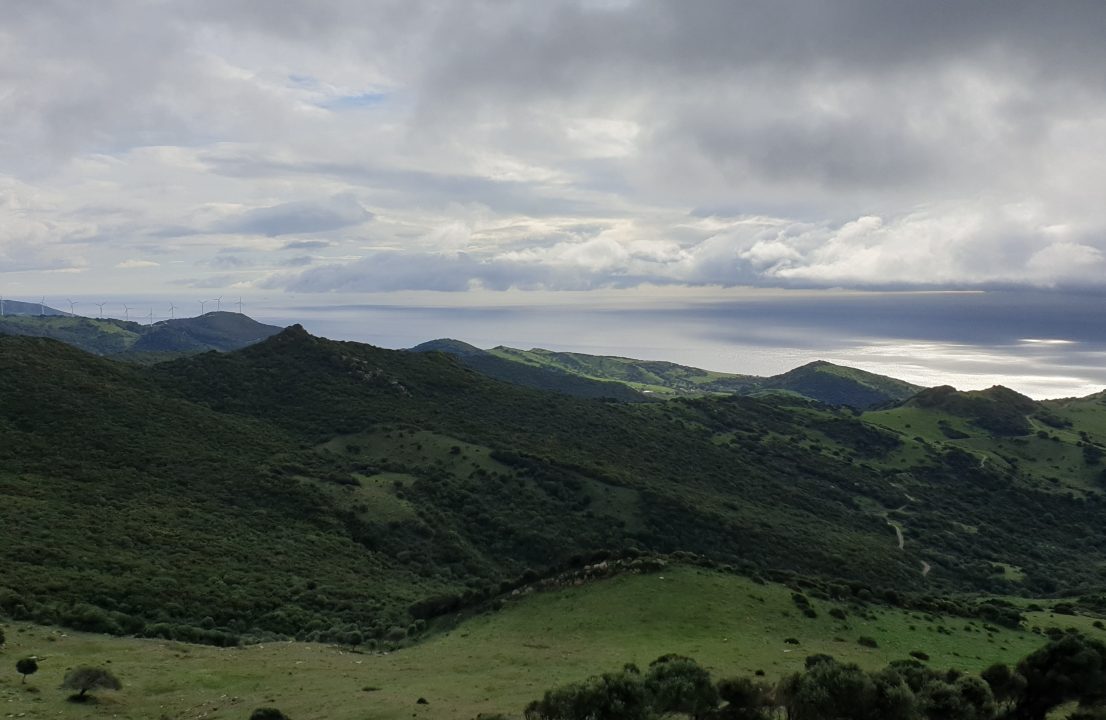
The Tesorillo Project (“Project” or “Tesorillo”) in the Cadiz Province in southern Spain contains a known gas discovery, which has the potential to hold gross unrisked Prospective Resources of 830 billion cubic feet of gas (Best Estimate), with upside in excess of 2 Tcf, according to a Competent Person’s Report undertaken by Netherland Sewell and Associates (“NSAI”) in 2015.
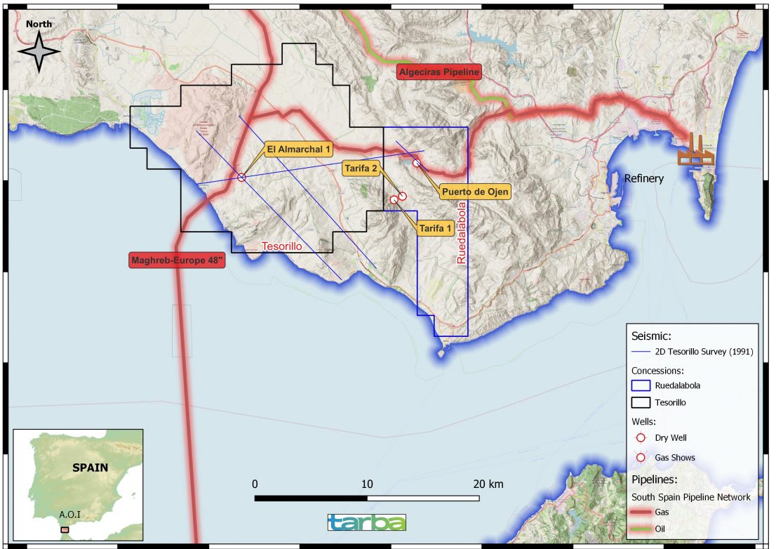
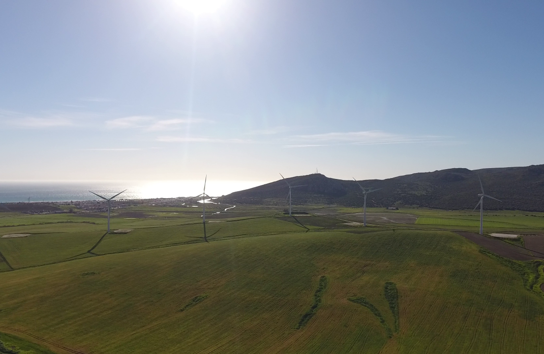
Tesorillo comprises two petroleum exploration licences, the Tesorillo and Ruedalabola Permits, which cover 38,000 ha in total. Both permits enjoy excellent access to infrastructure, as the project is located 3.9 km from the North African 48-inch Maghreb gas pipeline European landing point, providing easy access to the high-priced European gas market.
Tesorillo
Tesorillo contains the Almarchal-1 discovery well that was drilled in 1956-57 by Spanish operator Valdebro. The well intersected a thick section of gas pay, including some zones which flowed gas to surface on testing.
The section intersected by the discovery well Almarchal-1 has multi-Tcf gas potential and was originally located by gravity and dynamite seismic surveys, with a structural closure exceeding 70 km2 . Drill-stem tests and log analysis confirm 48 m of gas pay from two Miocene Aljibe Formation sandstone intervals, with a further 492 m of potential gas pay interpreted from logs yet unconfirmed by testing.
While ongoing work is awaiting a response from the regulatory authorities on re-instating the currently suspended licence, the operator and licence holder Tarba Energía S.L. (“Tarba”) carried out a work programme to test the known gas bearing sandstone sequences and de-risk the gas discovery on Tesorillo. A Competent Person’s Report by Netherland Sewell and Associates (“NSAI”) in 2015, estimated Prospective Resources of 830 Bcf (Best Estimate), with an upside of more than 2 Tcf.
The most recent work programme included general field studies required for the Environmental and Social Impact Assessment (‘ESIA’) report. Reprocessed 2D seismic data has been interpreted which, in combination with detailed surface structural geology and satellite imagery interpretation, provided further confidence about the subsurface geometry of the exploration target. Further work is planned once the regulatory situation is clarified.
These studies have led to the identification of four additional leads in the northern part of the block. Further geophysical studies are required, but these leads demonstrate additional prospectivity in the block that has been previously unknown. Multiple tests for an Audio Magnetotelluric survey (‘AMT’) have been conducted already, however the complex geology of Tesorillo requires further field calibration. The AMT survey will assess the subsurface geology on the licence area, and test for resistivity, serving as an additional indicator of hydrocarbon presence.
Ruedalabola
Ruedalabola contains the 1957 Puerto de Ojen-1 well, located 15km to the east of Almarchal, which displayed similar gas shows to Almarchal-1 but couldn’t be tested for mechanical reasons.
Further information on ownership
Prospex acquired 100% of Tarba on 15 April 2025 upon the acquisition of Warrego Energy’s entire shareholding in Tarba. Consequently, Prospex now owns 100% of the Tesorillo and Ruedalabola permits. In addition to the cash purchase price paid for the Tarba shares, Prospex is required to pay Warrego a 5% gross overriding royalty on the gross revenues from any future Tesorillo Project development (the “Tesorillo Project Royalty”). There is no monetary cap or maximum amount payable in respect of the Tesorillo Project Royalty. The Tesorillo and Ruedalabola permits are currently suspended.
For more information on Tarba, click here.
Gallery

Map